Salesforce Maps Mobile App Retirement: What Actually Changed + Next Steps
For B2B Sales Teams
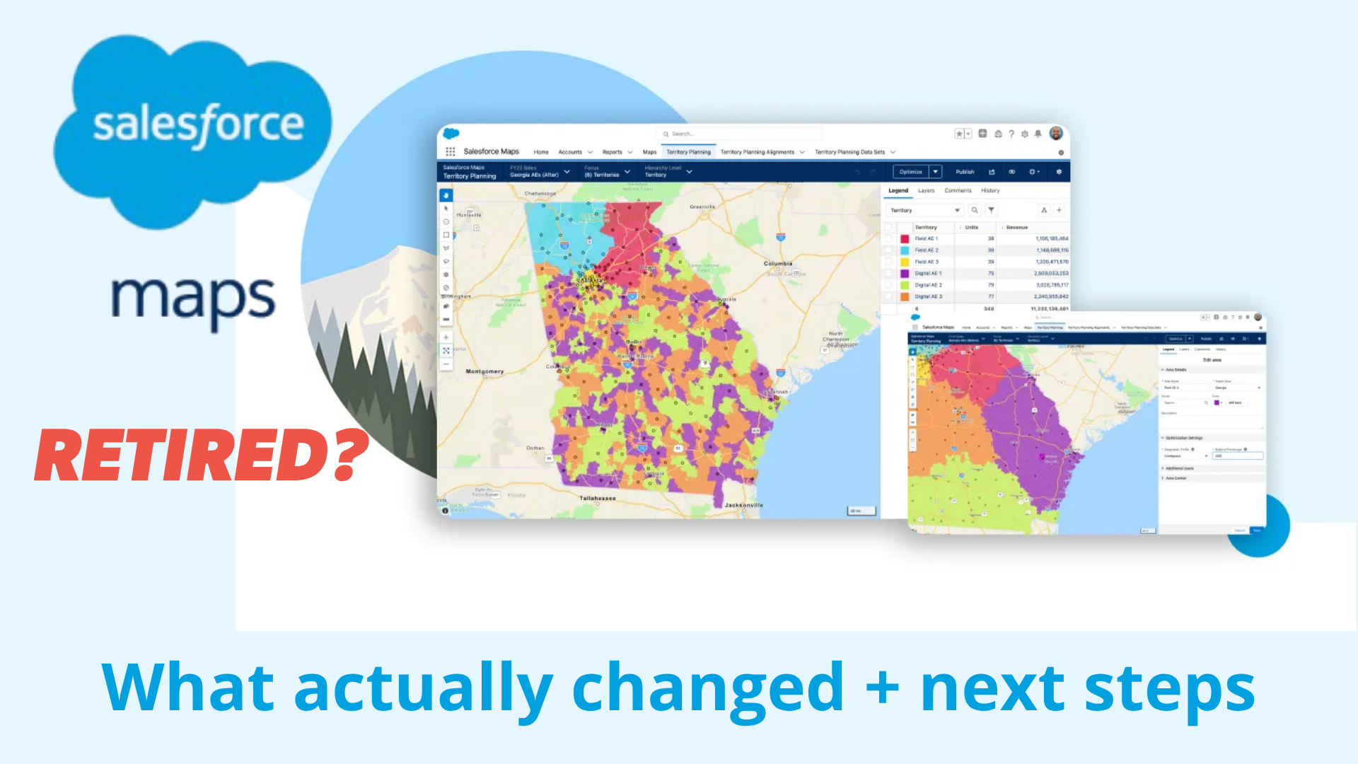
If you or your field team used Salesforce Maps on a phone or tablet, two related but separate things came to an end in August 2026, and Salesforce wasn't super clear on what this meant for Maps users.
This article breaks down exactly what retired, what didn't, what Salesforce recommended admins do, and what our own team found while testing the replacement experience firsthand.
Salesforce Maps Mobile App Retirement: What Actually Changed + Next Steps
- The Short Version
- Retirement #1: The Standalone Salesforce Maps Mobile App
- Retirement #2: Salesforce Maps Live Tracking Mobile
- What We're Seeing in Our Own Testing of Maps Mobile
- Admin Action Plan: What to Do Now If You Haven't Migrated
- At a Glance: What Changed and What Didn't
- Best Alternatives
- The Bottom Line
The Short Version
In August 2026, Salesforce retired two related but distinct things:
Retirement #1: The standalone Salesforce Maps mobile app that reps used to download separately from the Apple App Store or Google Play. Its functionality was folded into a "Maps Mobile" tab inside the main Salesforce mobile app.
Retirement #2: Salesforce Maps Live Tracking Mobile, a separate add-on feature that let managers see employees' real-time location in the field. Unlike Salesforce Maps, this one was NOT replaced internally. Salesforce's own documentation pointed customers to third-party tools instead.
Desktop Salesforce Maps wasn't touched by either change. If your team only ever used Maps on a computer, this mostly doesn't apply to you and your team.
If you're an admin and you're only getting to this now, the practical problem is that Salesforce never gave you a usage report to see who was actually still on the old app. You have to go find that out yourself, which we cover below.
Retirement #1: The standalone Salesforce Maps mobile app
Salesforce published an official retirement notice confirming the change. The stated reason was to consolidate mobile offerings into a single, more integrated experience. As of the retirement date, the standalone app stopped receiving support, updates, or continued availability from Salesforce.
Who was affected
Salesforce named a specific set of license editions whose mobile users were impacted:
- Salesforce Maps (Enterprise, Performance, Professional, Unlimited, OEM, and VAR Editions)
- Salesforce Maps Advanced (Enterprise, Performance, Professional, and Unlimited Editions)
- Sales Performance Management (Enterprise, Performance, and Unlimited Editions)
- Consumer Goods Cloud (Retail Execution, Contractor, and Field Sales Editions)
- Retail Execution (Merchandiser and Strategic Sales Editions)
- Industry Cloud Sales (Agentforce 1 and Einstein 1 Editions)
The Salesforce Maps desktop experience was not affected.
What Salesforce recommended, and what to do if you missed it
Salesforce's recommendation was to migrate affected users to the Maps Mobile tab inside the standard Salesforce Mobile App ahead of the retirement date, which meant adding the "Maps Mobile" navigation item to your org's mobile navigation settings in advance.
If that didn't happen before the deadline, don't panic. Nothing about your Salesforce data was lost, and the migration path is exactly the same now as it would have been before the cutoff, it's just no longer optional. Pull a list of users assigned the Salesforce Maps Permission Set License to see who's still depending on the old app, add the Maps Mobile navigation item if it isn't already there, and treat the rollout as overdue rather than impossible.
What happened if nothing was done
Salesforce laid out three consequences of inaction:
- App store removal: the app was supposed to come off the Apple App Store and Google Play Store on the retirement date.
- Support ended: existing installations stopped receiving security updates, bug fixes, and technical support.
- Functionality isn't guaranteed: the app may remain installed and openable on some devices, but Salesforce doesn't guarantee it keeps working without migrating to the supported mobile app.
One detail worth flagging: despite the stated plan to pull the app from both stores, Salesforce Maps was still listed and downloadable on the app stores as of this writing, well past the retirement date. What's harder to overlook once you're looking at that listing is the app's standing score: 1.9 out of 5 on the Apple App Store, and right around 2.0 out of 5 on Google Play. Honestly, I can't help but wonder whether that was at least part of the calculus behind retiring the standalone app in the first place. App Store and Play Store ratings are some of the most visible, least filtered reviews in software, sitting directly in front of anyone who searches for a product before a single sales conversation happens. Once those app pages go dark, history is erased and those scores stop being the first thing a prospective buyer sees.

“CRM usage increased more than 50% once our sales team adopted Badger”
Ken Buck
Regional Sales Manager, Danaher
Retirement #2: Salesforce Maps Live Tracking Mobile
This is the part that was easy to miss if you only skimmed the headline Salesforce Maps retirement notice, because it was a separate geo feature with its own separate retirement notice, landing on the same date.
Salesforce Maps Live Tracking Mobile let organizations see where field employees, vehicles, or equipment were located in real time, feeding into things like automated work order status updates, check-in and check-out tracking, and field performance dashboards. It was the piece that answered questions like "where is this rep right now."
As of the retirement date, Salesforce stopped generating new geolocation data through Live Tracking, which meant employee and asset locations simply stopped updating. It's worth being precise here: Salesforce Maps itself wasn't discontinued by this change. Only the Live Tracking Mobile feature went away.
Who should have cared about this one
If your organization only ever used Salesforce Maps for route planning and territory visualization, and never turned on Live Tracking, this second retirement changed nothing for you. If you'd been using Live Tracking to monitor field employee locations, confirm site visits, calculate mileage, or generate reimbursement reports, you had a genuine gap to fill, and it was a different gap than the one created by the app retirement above.
What we're seeing in our own testing of Maps Mobile
A quick note before this section: we're in the mapping space ourselves, so naturally we're invested in how Salesforce Maps actually functions now that it's folded into the standard Salesforce mobile app rather than living as its own app. Our team has been testing the new Maps Mobile experience hands-on, and this testing is still in progress. We'll keep updating this section as we get deeper into it.
For now, here's what we're seeing:
- Route creation on mobile is limited and inconsistent. Building a route directly within Maps Mobile inside the Salesforce app is possible, but it's clunky rather than smooth. In practice, the process works better for reps to build and then export routes from desktop rather than building them natively on mobile.
- No lasso selection tool. A feature reps commonly use to freehand and select a cluster of markers at once doesn't appear to be available in the mobile experience. Badger Maps invented it, but it's since become a standard for modern mapping tools.
- Stability issues. We've run into very slow loading, freezing, and problems getting markers to plot correctly during testing.
- Mapping provider change. CONFIRMED - Salesforce is no longer using Google Maps underneath Maps Mobile, which also means no more Google Places data.
- The interface reads like a shrunk-down desktop screen rather than a mobile-first design built for a phone.
None of this is official Salesforce guidance, and we want to be upfront that it's based on our own hands-on tinkering rather than a comprehensive audit. If your experience differs, that tracks. We'll revisit this section as we go deeper and as Salesforce continues shipping patches to the Maps package.
THE BEST APP FOR FIELD SALES PEOPLE
Learn how you can maximize your sales routes & sell more
Admin action plan: what to do now if you haven't migrated
The single biggest practical problem admins ran into with this retirement is that there was no built-in way to see who was actually using the app. The Salesforce admin console doesn't offer a usage report, a dashboard, or an export for Mobile Maps adoption, which means the audit work falls entirely on the admin, even now, after the fact.
Here's a practical sequence if you're catching up on this.
- Audit who's actually still using the standalone app. Since Salesforce won't surface this automatically, go get it directly: ask sales leadership and reps through a short survey or email, talk to power users who'll know instantly whether they touch Mobile Maps, raise it in team meetings, and use an existing Slack or Teams channel to collect responses in one place. Log every response (user, role, how they use the app) so you have an actual rollout list.
- Confirm your mobile app is configured correctly. Check that location fields are showing up where your team needs them (Accounts, Leads, Opportunities, or your custom objects), and that the "Maps Mobile" navigation item is added to your mobile navigation settings.
- Test the replacement experience yourself, first. Before telling anyone else to switch, open Maps Mobile inside the standard Salesforce app on an actual device. Confirm the map loads, directions work, and reps can get from a marker back to the related record without friction. Don't take this on faith, and don't assume it behaves the way the standalone app did.
- Communicate clearly and set a real internal deadline. Give affected users a clear notice of what's changed and what they need to do now. Screenshots or a short walkthrough go a long way here.
- Expect and prepare for pushback. Reps who were used to the standalone app may assume they've lost functionality outright. Frame it accurately: nothing was deleted, map features moved into the app most reps already open every day, and the transition is no longer optional.
If Live Tracking Mobile applied to your organization, treat that as its own separate project: document how it was being used across sales, operations, and payroll, identify what data you actually need to preserve (location, mileage, trip classification, reimbursement reporting), and pilot a replacement with a small group rather than rolling it out cold.
At a glance: what changed and what didn't
| Area | Status as of August 2026 |
|---|---|
| Standalone Salesforce Maps mobile app | No longer supported or updated; still technically listed in app stores |
| Salesforce Maps on desktop | Unaffected |
| Mobile map access generally | Moved to the "Maps Mobile" tab inside the standard Salesforce mobile app |
| Live Tracking Mobile (real-time employee location) | Retired outright, no internal replacement |
| Territory planning, geographic analysis | Unaffected, stays inside Salesforce Maps |
If you're evaluating alternatives...
A forced migration like this is a good moment to ask a question most teams don't get around to otherwise: was the tool you just got moved into actually built for how your reps work, or is it the best available option inside a platform that was never mobile-first to begin with?
Badger Maps was built the other way around. The mobile app isn't a secondary access point bolted onto a desktop tool, it's the primary experience. Badger covers what both of the retired pieces did, plus more: full route planning and territory mapping that works natively on the phone, and native, direct integration into Salesforce, syncing account, contact, and activity data both ways without a rep ever leaving the CRM's data model.
On the accountability piece specifically: instead of Live Tracking's always-on real-time location feed (the gap Salesforce pointed customers toward third-party tools like TripLog to fill), Badger uses check-ins. That's a deliberate design choice, not a missing feature. In practice, check-ins give managers the visit-level accountability and territory insight they actually need, without turning the app into a constant surveillance feed reps resent. It's still backed by accurate geo data at the moment of the visit, it's just tied to an actual action a rep takes, not a live tracker running in the background all day.
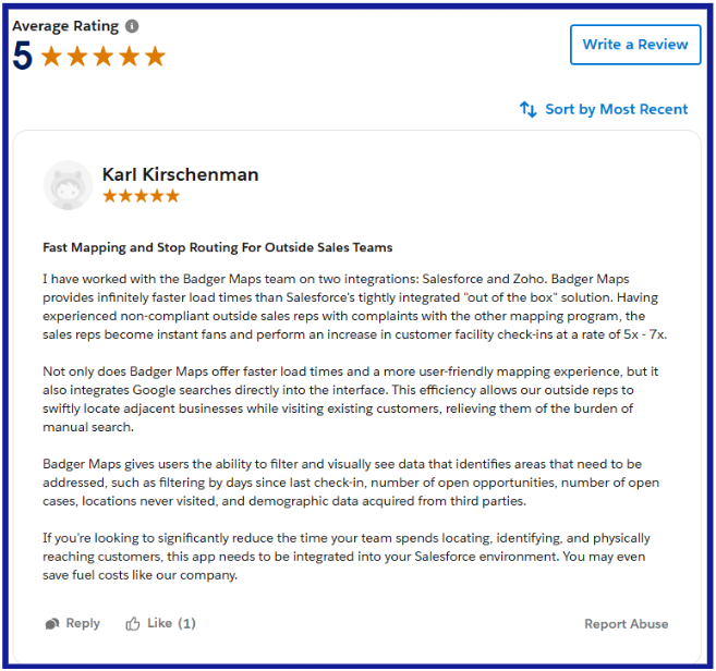
One review, from a partner who's implemented both platforms, put it plainly:
"I have worked with the Badger Maps team on two integrations: Salesforce and Zoho. Badger Maps provides infinitely faster load times than Salesforce's tightly integrated 'out of the box' solution. Having experienced non-compliant outside sales reps with complaints with the other mapping program, the sales reps become instant fans and perform an increase in customer facility check-ins at a rate of 5x - 7x.
Not only does Badger Maps offer faster load times and a more user-friendly mapping experience, but it also integrates Google searches directly into the interface. This efficiency allows our outside reps to swiftly locate adjacent businesses while visiting existing customers, relieving them of the burden of manual search."
- Verified review, Salesforce AppExchange
Bottom Line
If your team is already touching every rep's mobile setup for this migration regardless, it costs little to take a real look at Badger Maps alongside it. Book a demo to see the difference firsthand.


